


Select NOAA-NWS Forecast Office Text Products
(Product availability varies with seasons, forecast office, and weather.)
Forecast Discussion for Dallas/Fort Worth, TX
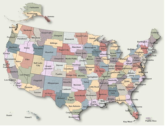
To Select Another NWS Office Click on Map or Choose from List
|
| Select Forecast Office: | Select Product: |
874 FXUS64 KFWD 270530 AFDFWD Area Forecast Discussion National Weather Service Fort Worth TX 1230 AM CDT Mon Jul 27 2026 ...New SHORT TERM, LONG TERM, AVIATION... .KEY MESSAGES... - A Heat Advisory remains in effect until 8 PM tonight for most of North Texas and eastern Central Texas for heat indices up to around 106. - Hot and rain-free weather will persist through the upcoming week with little relief in sight. && .SHORT TERM... (Today and tonight) Issued at 1224 AM CDT Mon Jul 27 2026 Continued southerly winds and subsident air from the lingering upper- level southern CONUS ridge will keep today hot and humid. Under mostly sunny skies, afternoon highs will be able to peak in the upper 90s to around 103 across much of North Texas, with Central Texas rising up into the mid 90s to around 100. The base NBM dewpoints are a bit too high during the afternoon hours, as actual observations show that we mix out a bit more, so have lowered dewpoints a bit. Even with lowered dewpoints, modest humidity will push afternoon heat indices into the upper 90s to around 106 degrees, with much of North Texas and eastern Central Texas having the higher heat indices. The current Heat Advisory remains in effect through 8 PM this evening. Overnight, expect temperatures to only bottom out in the mid 70s to low 80s, making for a warm and humid start to Tuesday. && .LONG TERM... (Tuesday through Sunday) Issued at 1224 AM CDT Mon Jul 27 2026 Over the next several days, the upper-level ridge will remain planted across much of the western and Central CONUS, with a trough setting up across the eastern CONUS coast. In response, expect continued hot and dry weather across the region. Afternoon highs through this week will peak in the upper 90s to around 102-104. With no real pattern shift expected until the end of the week into this upcoming weekend, have also lowered dewpoints each afternoon through Thursday to account for the better afternoon mixing. Daily peak heat indices will range from the upper 90s to around 106-107, meaning Heat Advisories will likely continue for portions of the region each day. Make sure to continue to take precautions against the heat, and know the signs of heat illness. Guidance continues to show the eastern CONUS trough digging further to the southwest late this week into the weekend, which will shunt the upper-level ridge back towards the Desert Southwest. This will place North and Central Texas in between the two upper-level features, with north-northwest flow aloft overtop. Both the deterministic long-range guidance and the ensembles show a disturbance pushing a "cold" front south through the region on Saturday, which would aid in shaving a few degrees off of afternoon highs. At this time, any precipitation looks to mainly be to our south and east. With it being a bit of a ways out, there is still uncertainty on the exact temperatures and location of any precipitation, so make sure to stay up to date with the forecast as we head through the week. && .AVIATION... (06Z TAFS) Issued at 1224 AM CDT Mon Jul 27 2026 Great flying weather is expected at all TAF sites over the next 24-30 hours as VFR and southerly winds around 7-12 kts prevail. Any cloud cover should be limited to some occasional high-based cirrus and perhaps diurnal cumulus in the afternoons. && .SPOTTER INFORMATION STATEMENT... Spotter activation is not expected at this time. && .PRELIMINARY POINT TEMPS/POPS... Dallas-Ft. Worth 102 81 102 81 / 0 0 0 0 Waco 99 77 99 78 / 0 0 0 0 Paris 98 77 99 77 / 0 0 0 0 Denton 102 79 102 80 / 0 0 0 0 McKinney 102 79 102 80 / 0 0 0 0 Dallas 103 81 103 82 / 0 0 0 0 Terrell 100 77 100 78 / 0 0 0 0 Corsicana 100 77 100 78 / 0 0 0 0 Temple 98 75 99 76 / 0 0 0 0 Mineral Wells 102 75 102 76 / 0 0 0 0 && .FWD WATCHES/WARNINGS/ADVISORIES... Heat Advisory until 8 PM CDT this evening for TXZ091>095-100>107- 116>123-131>135-146>148-162. && $$ SHORT TERM...Prater LONG TERM....Prater AVIATION...Prater |
Previous Forecast Discussions may be found at
NWS Dallas/Fort Worth, TX (FWD) Office Forecast Discussions.
(Click 'Previous Version' there to view past versions successively.
Some may differ only in time posted.)
Products Courtesy of NOAA-NWS
NWS Information Parsing Script by Ken True at Saratoga Weather - WFO and Products Scripts by SE Lincoln Weather.
Mapping by Curly at Michiana Weather and by Tom at My Mishawaka Weather.